Exploring Yellowstone by RV
Navigating Your RV Safely Inside America's Oldest National Park
Article Date: May, 2011
Article and Photography by Mark Quasius
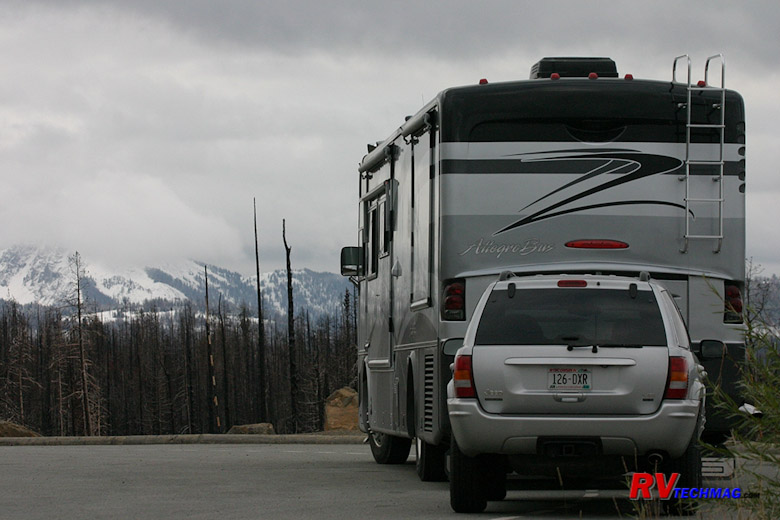
North Entrance
The north entrance connects Yellowstone to I-90 in the north via US-89. Historically this was the first entrance.
Early travelers used rail and stagecoach service to enter the park through this entrance. Immediately outside the park's border is the gateway
community of Gardiner, MT. Immediately inside the park is the Mammoth Hot Springs area. As you leave Gardiner you'll pass through the large
Roosevelt arch, erected in 1903 and dedicated by President Theodore Roosevelt at that time. This marks the first "official" entrance to the
park. Following US-89 north alongside the Yellowstone River for about 56 miles will take you to the intersection of I-90 at Livingston, MT.
This road is the least scenic of any of the entrance roads into Yellowstone. It's also the least challenging and virtually any vehicle is
capable of driving this route. RVers taking this route will undoubtedly choose to stay in Gardiner at one of two full service RV parks or
at Mammoth at the no service park service campground. Or they may choose to travel through to another location for base camp.
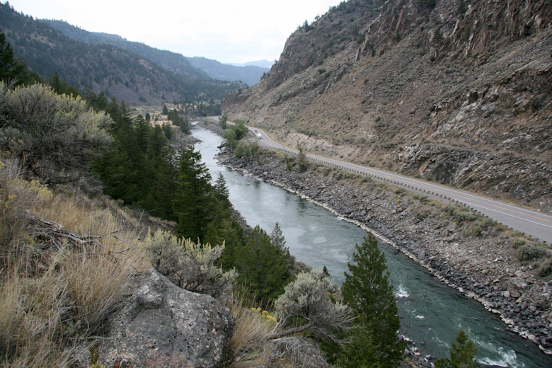
U.S. Route 89 follows the Yellowstone River as it enters the park at its north entrance at Gardiner, Montana.
West Entrance
The west entrance connects the park with the community of West Yellowstone, directly on the park's west border. West
Yellowstone is a full service gateway community with lots of lodging, restaurants, and shopping. A large percentage of visitors choose West
Yellowstone as their base camp. Full service RV parks are plentiful in the area, including the very popular Grizzly RV Park. If you want a
really unique experience, a 20 mile drive over Targhee Pass takes you to Island Park, ID where you can stay at Red Rock RV Resort, a great
choice for those who want to be out in the wilderness without the all the crowds but still retain full hookups. Once you leave West
Yellowstone you have two basic ways to go, either north or south, because the mountains to the west preclude any motorized travel over them.
Heading north from West Yellowstone takes you along US-191 towards Bozeman, MT. On this 75 mile trip you'll pass through
the scenic Gallatin Canyon and go through the Big Sky area. This is a very scenic drive and for a while actually passes through the edge of
Yellowstone National Park for a bit. The road has just enough twist to make it interesting without turning it into a white knuckle drive and
the few grades are short and not that steep. This road is perfectly suitable for any RV and it's scenic beauty and nearby parallel location
makes it a big reason to take this instead of US-89 out the north entrance.
Leaving West Yellowstone via US-20, the road heads west for a brief spell, then turns south. Eventually this will
connect you to I-15 at Idaho Falls. Shortly after you begin your southerly turn you'll climb Targhee Pass. This is a long grade, both up
and down, but there are truck lanes where needed as well as pull-off areas. It's not that long and then it's over so I wouldn't be concerned
about this pass either because it's capable of being navigated with any RV. After the pass the road gets fairly straight and easy as you
pass through Island Park, ID on your way down to Rexburg, ID. There are lots of scenic areas here to see too, which is why a number of
RVers spend time in Island Park as well as Yellowstone. South of Rexburg it is possible to access Grand Teton National Park via US-26
into Jackson, WY but it's much easier to use the southern entrance if this is your plan. Once on I-50 you have easy access to the
Snake River Valley area that extends to Boise via I-86 or you can continue on I-15 down to the Salt Lake City area.
|
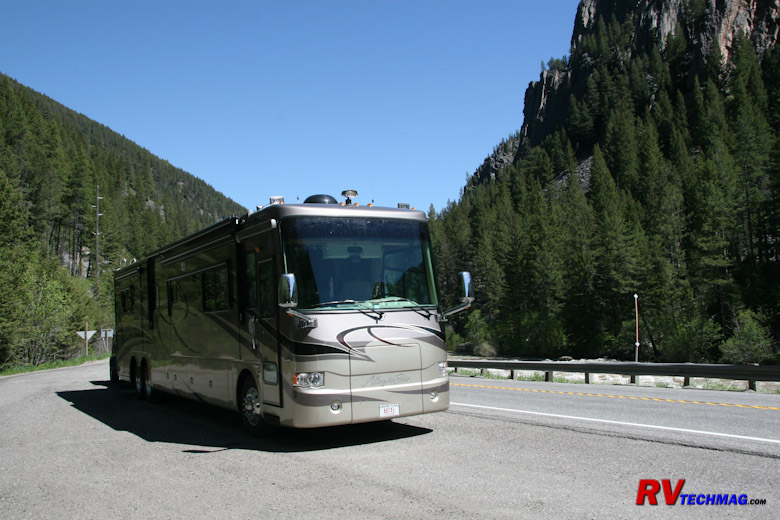
US-191 north of West Yellowstone passes through the scenic Gallatin Canyon.
|
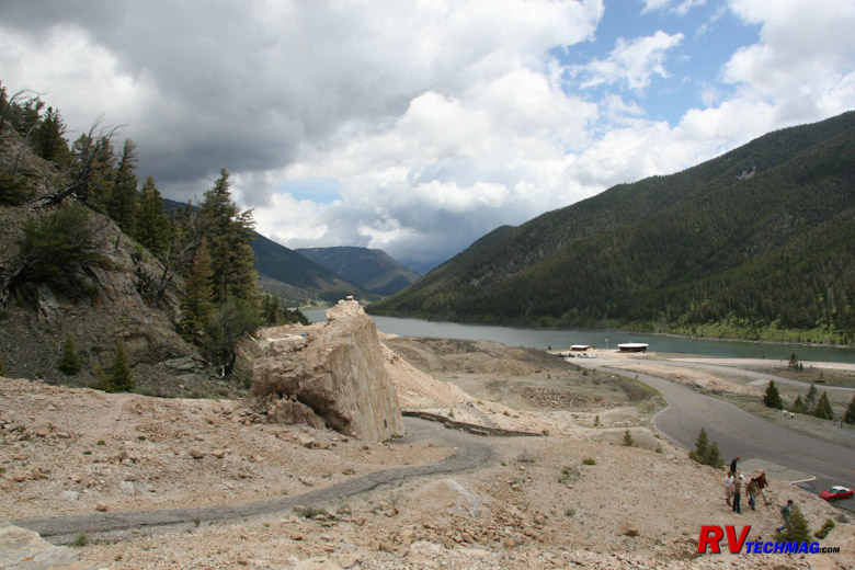
U.S. Route 287 passes by Hebgen Lake, the epicenter of the 1959 Yellowstone Earthquake on its way to West Yellowstone.
|
South Entrance
The south entrance connects Yellowstone to Grand Teton National Park, which is it's sibling to the south. US-89 is
the highway extending south from Yellowstone and as you leave the central area of Yellowstone you'll actually cross the Continental Divide
three times before you exit the park. The grades are numerous but they are short and the route takes you through densely wooded forests and
past some Lewis Lake and other scenic areas. You'll see all sorts of RVs on this route so don't worry about that. As you enter Grand Teton
National Park you won't have any issues either. Grand Teton is basically a flat area that has the Teton Range jutting up at it's western
flank. There are no roads over that wall so every road in the park is nice and easy. If you are planning a combined Yellowstone-Grand Teton
trip, the southern entrance is the route you'll want to use.
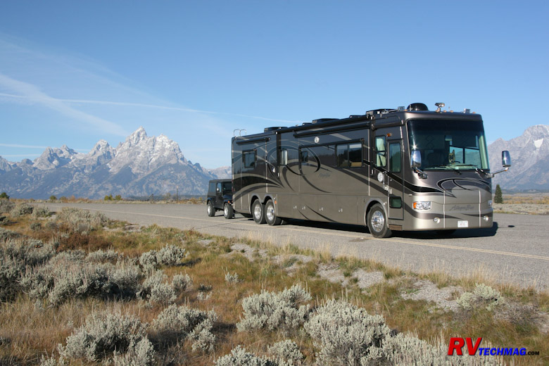
Stopping for breakfast on US-89 in the Grand Tetons.
East Entrance
The east entrance is the mountainous one. Leaving Fishing Bridge, you'll head due east as the road winds itself through
forests, around the lake, around cliffs, etc. Eventually you get to Sylvan Pass, where the real grades begin. In recent years the park service
has rebuilt this road and it's no longer the rickety cliff hanger it once was. The road now does cling to the side of steep mountains but the
stone retaining walls and new, wider asphalt roads make this another excellent scenic drive. Unless you have a severe phobia of steep drop-offs
alongside the road you won't have any issues here. Even RVers with a slight disdain for drop-offs won't find any issue on this new road.
One huge benefit to this road is it's accessibility to other desirable locations. Heading east you'll be on both US-16
and US-14 as you pass through Pahaska Teepee on the eastern border of the park. Buffalo Bill Cody had a hunting lodge here and you can stop and
see it and eat at the restaurant should you so choose. Continuing on you'll pass through Shoshone Canyon and Wapiti Valley, eventually going
around Buffalo Bill Reservoir and passing through a tunnel as you approach Cody, WY from the west. This is an easy drive and Cody, WY is a
popular location for many RVers who spend a night or two here. Leaving Cody you can fan out on one of three roads, US-14A to the northeast,
US-14 to the north, and WY-120 to the southeast. Heading east you'll eventually encounter the Bighorn Mountains which can be a serious issue
for RVers so be sure to read the section on crossing the Bighorns before making that decision.
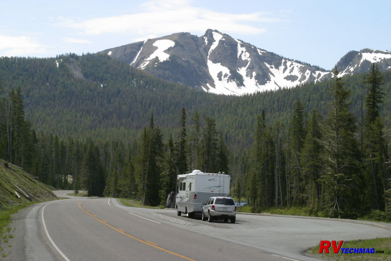
The east entrance road on the way to Sylvan Pass.
Northeast Entrance
Okay, now you are talking about not just the most scenic drive into Yellowstone but, as Charles Kuralt has stated, "The most
scenic drive in America". This entrance leaves the northeast corner of Yellowstone and takes you into the Beartooth Mountains. However, it's also
the most daunting so read this section carefully before jumping on this.
The northeast entrance passes through Lamar Valley after leaving Tower Junction. Two miles after crossing the park boundary
you arrive at the small village of Silver Gate, a one time mining community that became run down. It's presently in a reconstruction/revival mode.
Another five miles brings you to Cooke City, MT. You are now on US-212, which is also known as the Beartooth Highway at this point. At this point
the highway climbs into the spectacular Beartooth Mountains. After a few miles you'll get to a tee intersection where WY-296 peels off to the east
and heads through Sunlight Basin. This is known as the Chief Joseph Highway, so named because Chief Joseph led the Nez Perce tribe through here
during it's flight from the US Cavalry. At this point you can choose to continue on US-212 to Red Lodge, MT and eventually hook up with I-90 just
west of Billings, MT or you can head east on the Chief Joseph, choosing to access Red Lodge via a flatter route that bypasses the summits of the
Beartooths or continue on east to arrive at Cody, WY. The initial grades of the Chief Joseph Highway, near the tee intersection, are numerous
and you'll be making the RV work. But they are navigable and they don't have the steep precipices that can be unsettling to some. Once you get
to Dead Indian Pass the roads are pretty flat.
If you choose to continue on over the Beartooths I hope you are not driving an RV. My reasoning for this is as follows:
The Beartooths consist of two passes with a large high elevation saddle in between. If you take a southerly route you'll
begin from Red Lodge, MT and head through forested slopes as you gradually climb your way onto the mountains. Eventually you'll reach the switchbacks
on the north face. This where it gets steep. You'll be pedal to the metal as you climb this series of switchbacks. They are relentless but every
now and then there's a runoff radius where you can pull over to enjoy the view and rest the coach. When you finally complete them you'll be at
the Alpine Overlook parking area that features rest rooms, a parking lot, and a hiking trail looking out over the valley. After this the climb
isn't so bad as you wind your way onto the West Summit.
You'll drive past frozen mountain lakes, glaciers, a ski area, and over tundra. Eventually you'll get to Top of the
World Store, a great place to stop. You can park in the large gravel area across the road and unhook the toad to go do some exploring if you
like. Leaving this area you'll begin a gradual descent down into Cooke City, MT and eventually Yellowstone itself.
|
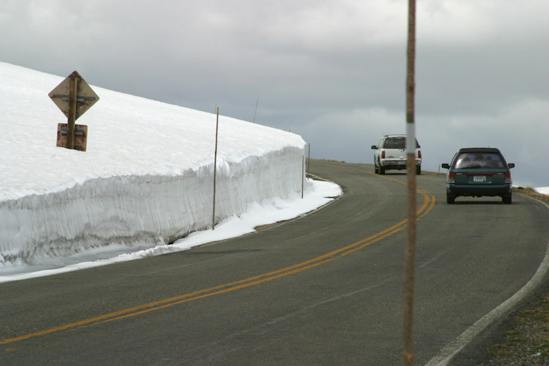
Heavy snow precludes an early opening of the Beartooth Highway which typically opens around Memorial Day but can be delayed, depending on
the weather. This image was taken late June and shows the typical height of snow drifts near the pass.
|
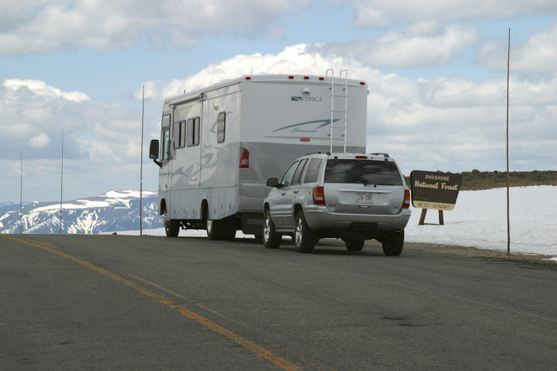
Beartooth Pass at 11,000' in late June.
|
|
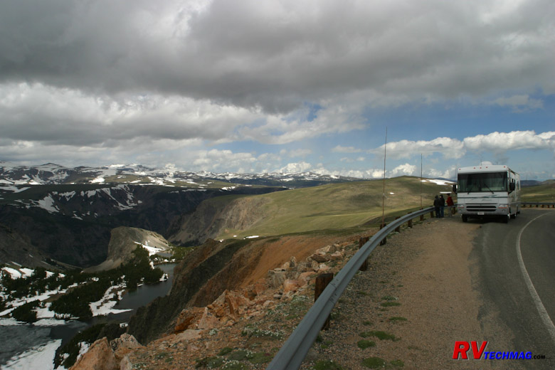
One of a number of scenic pullouts that you'll need to use to allow faster traffic to pass.
|
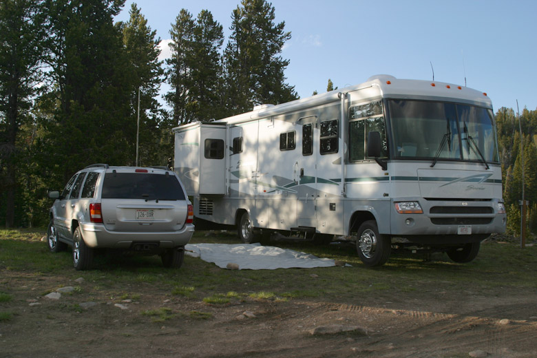
The campground at Top of the World Store isn't full hook-up but is right in the center of the scenery.
|
Now, if you approach this pass from the Red Lodge side you'll make your engine work hard. But, if your cooling system is
up to snuff and your coach runs well, it's very doable. If you have a severe distaste for steep slopes and switchbacks you may want to reconsider
this and take my Belfry bypass route. More on that later. We've climbed this with a 2003 Itasca Suncruiser 33' gasser (Workhorse chassis), a 2004
40' Allegro Bus (400 Cummins), as well as with our 2007 42' Allegro Bus (400 Cummins). I know of others who have done it with 330 HP Cats as well.
One trick we employ is to unhook the toad near the US Forest Service sign at the base of the climb, then rehook up top at the Alpine Visitor's
Center. That removes some of the extra weight that I would otherwise have to drag up the steep grades and also makes it easier to fit into a
pulloff should traffic back up behind me or I just want to take pictures. There's lots of pulloffs on this climb but they are small so splitting
off your toad is a huge advantage in that respect.
If you were to do this route in reverse I fear you would get into trouble. Heading downslope on the Cooke City side is no
problem because the grades aren't as steep and there's lots of level spots to cool your brakes on the way down. If you were to head northbound
towards Red Lodge the switchbacks on the north face would never give your brakes a moments rest and I fear that they would overheat with a
large, heavy vehicle such as an RV. If you really have to head in this direction take the Belfry bypass route.
The Belfry bypass route allows you to skip the steep switchback grades of the north face, yet still traverse between Red
Lodge and Yellowstone. I have even had to take this route southbound a couple of times when September snow storms temporarily pelted the north
face of the mountains. The Belfry bypass consists of leaving Red Lodge via MT-308, which connects to US-212 (Main Street) at the bridge, just
south of Red Lodge. It heads east through Washoe and passes the Bearcreek Mine disaster site for a bit over 10 miles until it reaches MT-72.
Heading south on MT-72, which becomes WY-120 after 11 miles, reaches WY-296 after 38 miles. Heading west on WY-296, also known as the Chief
Joseph Highway, you'll follow the Clark's Fork along through Dead Indian Pass and Sunlight Basin, eventually reaching US-212, the Beartooth
Highway. The Chief Joseph is a much easier route and you won't run into the issues that you would face on the north face switchbacks of the
Beartooth Highway. Therefore, it's an excellent alternative for bypassing them and it can be traveled in either direction. It's also a good
safety net in case any early snowfalls happen to slicken the extreme conditions of the upper switchbacks on the north end of the saddle. Once
you do arrive at the intersection with US-212 you can either turn left and go down towards Cooke City and Yellowstone or you can turn right
and go up to Top of the World to unhook and do some exploring with the toad. Actually, you can even camp at Top of the World, although the
sites are primitive. They do have water and sewer but no electricity.
Return to Home Page
If you enjoyed this article be sure to recommend RVtechMag.com to your friends, like us on Facebook or Twitter
or subscribe to our RSS feed.


|


