Exploring Yellowstone by RV
Navigating Your RV Safely Inside America's Oldest National Park
Article Date: May, 2011
Article and Photography by Mark Quasius
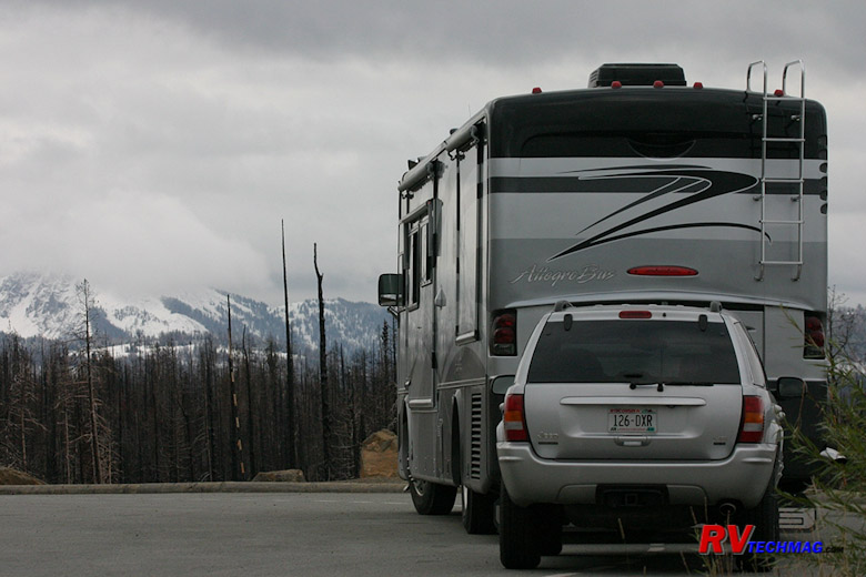
Yellowstone is America's first national park. It's large enough that it's actually found in three state - Idaho,
Montana, and Wyoming. This expansive area is surrounded by mountains and many RVers are not quite sure about how safe travel is in these
areas. Couple that with the fact that travelers approaching from the east also have to content with the Bighorn Mountains and you have
some real questions about just where to drive and still be safe.
We've been traveling to Yellowstone in various vehicles over the last 25 years and have made countless trips to
this area in a number of different sized RVs as well as SUVs. I'll offer up some advice here based on my insight into the various routes
that we've experienced. This information will not be geared to travelers in passenger cars or other lighter vehicles because there's
really no limits as to which roads they can take. Instead, I'll gear this information towards RVers driving large motorhomes because
that's where the unique personalities of the various routes come into play and have some serious affect.
The Park
Mention Yellowstone and the first thoughts that come to mind are bears and Old Faithful. While Old Faithful is
certainly the most popular attraction in Yellowstone, it's merely one element of a huge thermal area. In fact, one fourth of the world's
geysers are found in Yellowstone. But, the park is much more than geysers, hot springs, and boiling mud pots. Yellowstone Lake is the
largest mountain lake in the United States.
Snow runoff feeds the lake and a number of streams and rivers, which flow into the lower areas. These valleys are
host to a plethora of fauna, including bison, elk, grizzly bears, bighorn sheep, and more than 100 different species of birds. Anyone
who has stood at the brink of the Yellowstone River's 308-foot-tall Lower Falls will never forget the view down the Grand Canyon
of the Yellowstone.
|
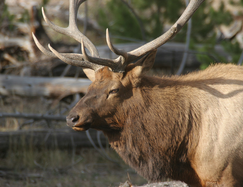
Bull elk can be found in a number of areas. The fall rut is the best time to see them as they gather harems and spar with other males.
|
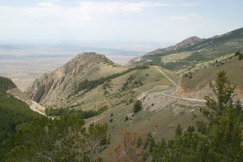
The elevation gain encountered in the mountains approaching Yellowstone.
|
How Big Is It?
Yellowstone encompasses more than 2.2-million acres. Mostly in Wyoming, it overflows into Montana and Idaho.
In 1891, the Army Corps of Engineers constructed Yellowstone's roads in a figure-eight pattern. Today's roads basically follow those
same routes and are known as the Grand Loop, which is 154 miles long.
Mention Yellowstone and the first thoughts that come to mind are bears and Old Faithful. While Old Faithful is
certainly the most popular attraction in Yellowstone, it's merely one element of a huge thermal area. In fact, one fourth of the world's
geysers are found in Yellowstone. But, the park is much more than geysers, hot springs, and boiling mud pots. Yellowstone Lake is the
largest mountain lake in the United States.
Five Entrances
Yellowstone has 5 entrances and can be approached from virtually any direction. In addition, there are three routes over
the Bighorn Mountains that need to be fully appreciated before an RVer makes his choice as to which one to take. I'll give my perspective on
all of these routes and attempt to illustrate with pictures whenever possible. Hopefully this will give you some good information to help you
plan your trip. The main thing to remember is that Yellowstone is spectacular! There is no reason for any RVer to avoid going there. If you plan
your route accordingly you'll find this to be one of the greatest RV trips you've ever taken. Hopefully this web page will help you make the
decisions that will lead to an enjoyable time for all.
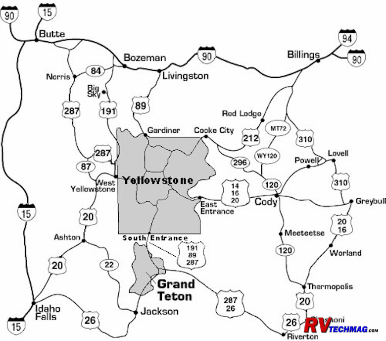
Yellowstone's roads are laid out in a figure-eight loop design. Five spurs connect the Grand Loop with the gateway communities.
Yellowstone is basically a large squarish shaped park with a total of five entrance gates, one on each edge of the park
plus one coming in at the northeast corner. These spur roads allow visitor access from virtually any direction. But, each entrance has a totally
different character than the others because of it's unique geography at that edge of the park. Some routes are very scenic but have lots of
steep grades and curves while some are fairly flat and just plain boring. Furthermore, once you're in Yellowstone there are a number of key
areas to see and places to base camp from. Each has a unique ambiance in it's own so that further affects your decision on which route to
take. The interior roads have undergone extensive remodeling in recent years, making them more RV friendly. Following is a description of
each particular entrance.
North Entrance
The north entrance connects Yellowstone to I-90 in the north via US-89. Historically this was the first entrance.
Early travelers used rail and stagecoach service to enter the park through this entrance. Immediately outside the park's border is the gateway
community of Gardiner, MT. Immediately inside the park is the Mammoth Hot Springs area. As you leave Gardiner you'll pass through the large
Roosevelt arch, erected in 1903 and dedicated by President Theodore Roosevelt at that time. This marks the first "official" entrance to the
park. Following US-89 north alongside the Yellowstone River for about 56 miles will take you to the intersection of I-90 at Livingston, MT.
This road is the least scenic of any of the entrance roads into Yellowstone. It's also the least challenging and virtually any vehicle is
capable of driving this route. RVers taking this route will undoubtedly choose to stay in Gardiner at one of two full service RV parks or
at Mammoth at the no service park service campground. Or they may choose to travel through to another location for base camp.
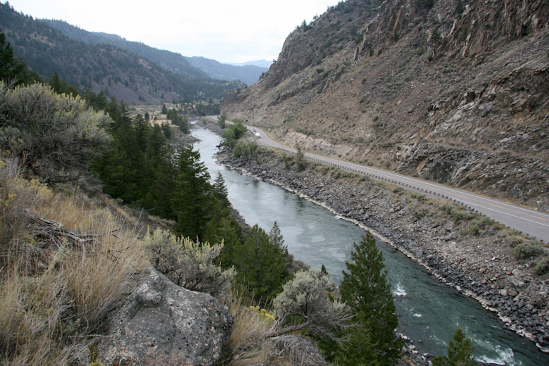
U.S. Route 89 follows the Yellowstone River as it enters the park at its north entrance at Gardiner, Montana.
West Entrance
The west entrance connects the park with the community of West Yellowstone, directly on the park's west border. West
Yellowstone is a full service gateway community with lots of lodging, restaurants, and shopping. A large percentage of visitors choose West
Yellowstone as their base camp. Full service RV parks are plentiful in the area, including the very popular Grizzly RV Park. If you want a
really unique experience, a 20 mile drive over Targhee Pass takes you to Island Park, ID where you can stay at Red Rock RV Resort, a great
choice for those who want to be out in the wilderness without the all the crowds but still retain full hookups. Once you leave West
Yellowstone you have two basic ways to go, either north or south, because the mountains to the west preclude any motorized travel over them.
Heading north from West Yellowstone takes you along US-191 towards Bozeman, MT. On this 75 mile trip you'll pass through
the scenic Gallatin Canyon and go through the Big Sky area. This is a very scenic drive and for a while actually passes through the edge of
Yellowstone National Park for a bit. The road has just enough twist to make it interesting without turning it into a white knuckle drive and
the few grades are short and not that steep. This road is perfectly suitable for any RV and it's scenic beauty and nearby parallel location
makes it a big reason to take this instead of US-89 out the north entrance.
Leaving West Yellowstone via US-20, the road heads west for a brief spell, then turns south. Eventually this will
connect you to I-15 at Idaho Falls. Shortly after you begin your southerly turn you'll climb Targhee Pass. This is a long grade, both up
and down, but there are truck lanes where needed as well as pull-off areas. It's not that long and then it's over so I wouldn't be concerned
about this pass either because it's capable of being navigated with any RV. After the pass the road gets fairly straight and easy as you
pass through Island Park, ID on your way down to Rexburg, ID. There are lots of scenic areas here to see too, which is why a number of
RVers spend time in Island Park as well as Yellowstone. South of Rexburg it is possible to access Grand Teton National Park via US-26
into Jackson, WY but it's much easier to use the southern entrance if this is your plan. Once on I-50 you have easy access to the
Snake River Valley area that extends to Boise via I-86 or you can continue on I-15 down to the Salt Lake City area.
|
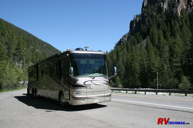
US-191 north of West Yellowstone passes through the scenic Gallatin Canyon.
|
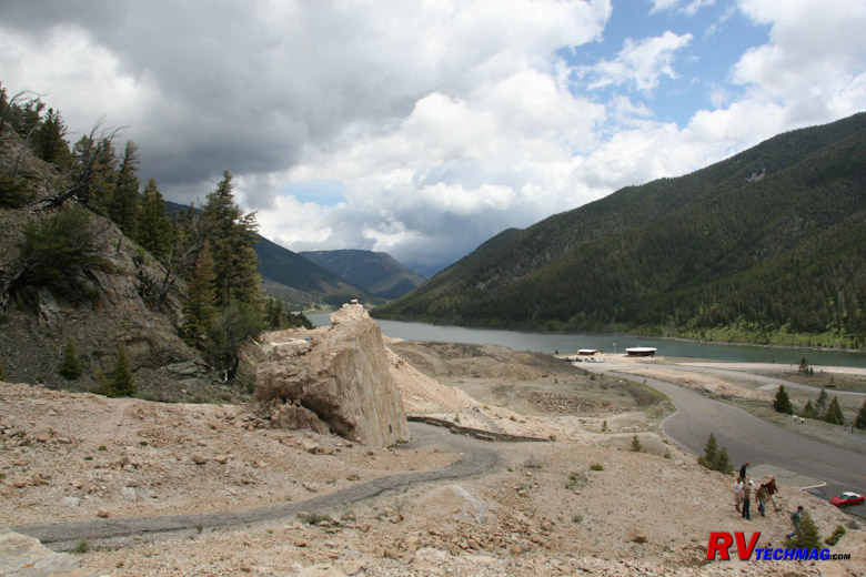
U.S. Route 287 passes by Hebgen Lake, the epicenter of the 1959 Yellowstone Earthquake on its way to West Yellowstone.
|
South Entrance
The south entrance connects Yellowstone to Grand Teton National Park, which is it's sibling to the south. US-89 is
the highway extending south from Yellowstone and as you leave the central area of Yellowstone you'll actually cross the Continental Divide
three times before you exit the park. The grades are numerous but they are short and the route takes you through densely wooded forests and
past some Lewis Lake and other scenic areas. You'll see all sorts of RVs on this route so don't worry about that. As you enter Grand Teton
National Park you won't have any issues either. Grand Teton is basically a flat area that has the Teton Range jutting up at it's western
flank. There are no roads over that wall so every road in the park is nice and easy. If you are planning a combined Yellowstone-Grand Teton
trip, the southern entrance is the route you'll want to use.
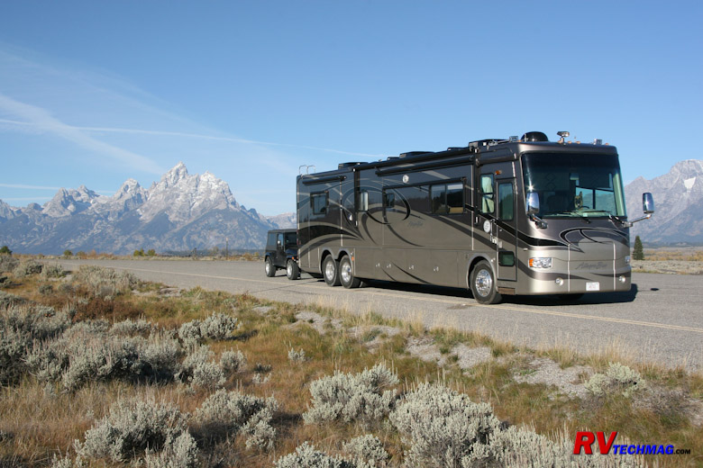
Stopping for breakfast on US-89 in the Grand Tetons.
East Entrance
The east entrance is the mountainous one. Leaving Fishing Bridge, you'll head due east as the road winds itself through
forests, around the lake, around cliffs, etc. Eventually you get to Sylvan Pass, where the real grades begin. In recent years the park service
has rebuilt this road and it's no longer the rickety cliff hanger it once was. The road now does cling to the side of steep mountains but the
stone retaining walls and new, wider asphalt roads make this another excellent scenic drive. Unless you have a severe phobia of steep drop-offs
alongside the road you won't have any issues here. Even RVers with a slight disdain for drop-offs won't find any issue on this new road.
One huge benefit to this road is it's accessibility to other desirable locations. Heading east you'll be on both US-16
and US-14 as you pass through Pahaska Teepee on the eastern border of the park. Buffalo Bill Cody had a hunting lodge here and you can stop and
see it and eat at the restaurant should you so choose. Continuing on you'll pass through Shoshone Canyon and Wapiti Valley, eventually going
around Buffalo Bill Reservoir and passing through a tunnel as you approach Cody, WY from the west. This is an easy drive and Cody, WY is a
popular location for many RVers who spend a night or two here. Leaving Cody you can fan out on one of three roads, US-14A to the northeast,
US-14 to the north, and WY-120 to the southeast. Heading east you'll eventually encounter the Bighorn Mountains which can be a serious issue
for RVers so be sure to read the section on crossing the Bighorns before making that decision.
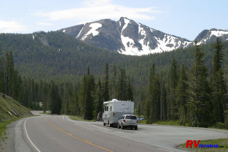
The east entrance road on the way to Sylvan Pass.
Northeast Entrance
Okay, now you are talking about not just the most scenic drive into Yellowstone but, as Charles Kuralt has stated, "The most
scenic drive in America". This entrance leaves the northeast corner of Yellowstone and takes you into the Beartooth Mountains. However, it's also
the most daunting so read this section carefully before jumping on this.
The northeast entrance passes through Lamar Valley after leaving Tower Junction. Two miles after crossing the park boundary
you arrive at the small village of Silver Gate, a one time mining community that became run down. It's presently in a reconstruction/revival mode.
Another five miles brings you to Cooke City, MT. You are now on US-212, which is also known as the Beartooth Highway at this point. At this point
the highway climbs into the spectacular Beartooth Mountains. After a few miles you'll get to a tee intersection where WY-296 peels off to the east
and heads through Sunlight Basin. This is known as the Chief Joseph Highway, so named because Chief Joseph led the Nez Perce tribe through here
during it's flight from the US Cavalry. At this point you can choose to continue on US-212 to Red Lodge, MT and eventually hook up with I-90 just
west of Billings, MT or you can head east on the Chief Joseph, choosing to access Red Lodge via a flatter route that bypasses the summits of the
Beartooths or continue on east to arrive at Cody, WY. The initial grades of the Chief Joseph Highway, near the tee intersection, are numerous
and you'll be making the RV work. But they are navigable and they don't have the steep precipices that can be unsettling to some. Once you get
to Dead Indian Pass the roads are pretty flat.
If you choose to continue on over the Beartooths I hope you are not driving an RV. My reasoning for this is as follows:
The Beartooths consist of two passes with a large high elevation saddle in between. If you take a southerly route you'll
begin from Red Lodge, MT and head through forested slopes as you gradually climb your way onto the mountains. Eventually you'll reach the switchbacks
on the north face. This where it gets steep. You'll be pedal to the metal as you climb this series of switchbacks. They are relentless but every
now and then there's a runoff radius where you can pull over to enjoy the view and rest the coach. When you finally complete them you'll be at
the Alpine Overlook parking area that features rest rooms, a parking lot, and a hiking trail looking out over the valley. After this the climb
isn't so bad as you wind your way onto the West Summit.
You'll drive past frozen mountain lakes, glaciers, a ski area, and over tundra. Eventually you'll get to Top of the
World Store, a great place to stop. You can park in the large gravel area across the road and unhook the toad to go do some exploring if you
like. Leaving this area you'll begin a gradual descent down into Cooke City, MT and eventually Yellowstone itself.
|
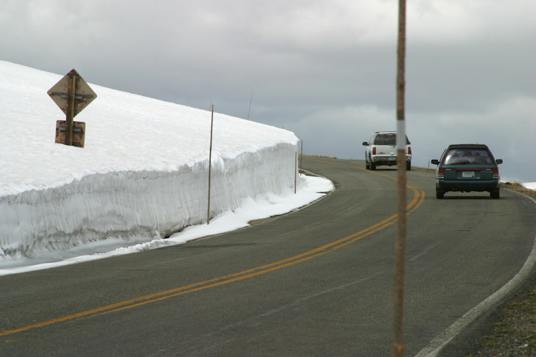
Heavy snow precludes an early opening of the Beartooth Highway which typically opens around Memorial Day but can be delayed, depending on
the weather. This image was taken late June and shows the typical height of snow drifts near the pass.
|
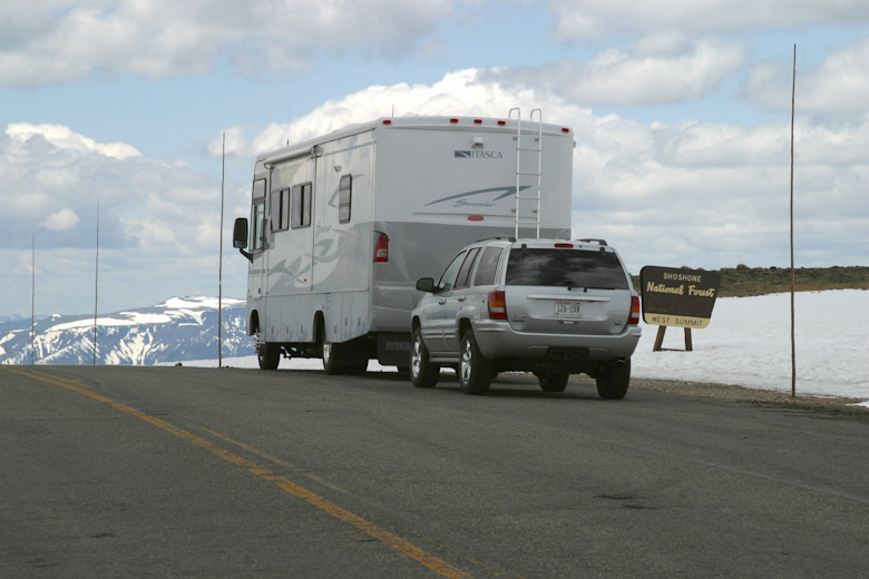
Beartooth Pass at 11,000' in late June.
|
|
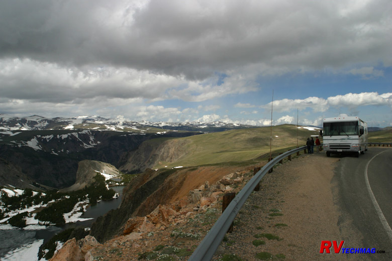
One of a number of scenic pullouts that you'll need to use to allow faster traffic to pass.
|
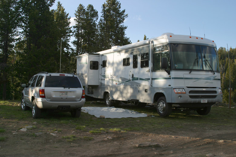
The campground at Top of the World Store isn't full hook-up but is right in the center of the scenery.
|
Now, if you approach this pass from the Red Lodge side you'll make your engine work hard. But, if your cooling system is
up to snuff and your coach runs well, it's very doable. If you have a severe distaste for steep slopes and switchbacks you may want to reconsider
this and take my Belfry bypass route. More on that later. We've climbed this with a 2003 Itasca Suncruiser 33' gasser (Workhorse chassis), a 2004
40' Allegro Bus (400 Cummins), as well as with our 2007 42' Allegro Bus (400 Cummins). I know of others who have done it with 330 HP Cats as well.
One trick we employ is to unhook the toad near the US Forest Service sign at the base of the climb, then rehook up top at the Alpine Visitor's
Center. That removes some of the extra weight that I would otherwise have to drag up the steep grades and also makes it easier to fit into a
pulloff should traffic back up behind me or I just want to take pictures. There's lots of pulloffs on this climb but they are small so splitting
off your toad is a huge advantage in that respect.
If you were to do this route in reverse I fear you would get into trouble. Heading downslope on the Cooke City side is no
problem because the grades aren't as steep and there's lots of level spots to cool your brakes on the way down. If you were to head northbound
towards Red Lodge the switchbacks on the north face would never give your brakes a moments rest and I fear that they would overheat with a
large, heavy vehicle such as an RV. If you really have to head in this direction take the Belfry bypass route.
The Belfry bypass route allows you to skip the steep switchback grades of the north face, yet still traverse between Red
Lodge and Yellowstone. I have even had to take this route southbound a couple of times when September snow storms temporarily pelted the north
face of the mountains. The Belfry bypass consists of leaving Red Lodge via MT-308, which connects to US-212 (Main Street) at the bridge, just
south of Red Lodge. It heads east through Washoe and passes the Bearcreek Mine disaster site for a bit over 10 miles until it reaches MT-72.
Heading south on MT-72, which becomes WY-120 after 11 miles, reaches WY-296 after 38 miles. Heading west on WY-296, also known as the Chief
Joseph Highway, you'll follow the Clark's Fork along through Dead Indian Pass and Sunlight Basin, eventually reaching US-212, the Beartooth
Highway. The Chief Joseph is a much easier route and you won't run into the issues that you would face on the north face switchbacks of the
Beartooth Highway. Therefore, it's an excellent alternative for bypassing them and it can be traveled in either direction. It's also a good
safety net in case any early snowfalls happen to slicken the extreme conditions of the upper switchbacks on the north end of the saddle. Once
you do arrive at the intersection with US-212 you can either turn left and go down towards Cooke City and Yellowstone or you can turn right
and go up to Top of the World to unhook and do some exploring with the toad. Actually, you can even camp at Top of the World, although the
sites are primitive. They do have water and sewer but no electricity.
Roads In Yellowstone
Okay, now you know how to get to the park. What about how to get around in the park. Yellowstone has lots of tourists.
There are a large number of areas of interest and the wildlife walks wherever it wants to and creates traffic jams too. So, you don't want to
take your RV sightseeing. Use it as your base camp and take the toad to do your sightseeing. You're never going to be able to find a place to
park a large RV in this park. However, all of the roads inside the park are navigable by RVs, with the exception of one.
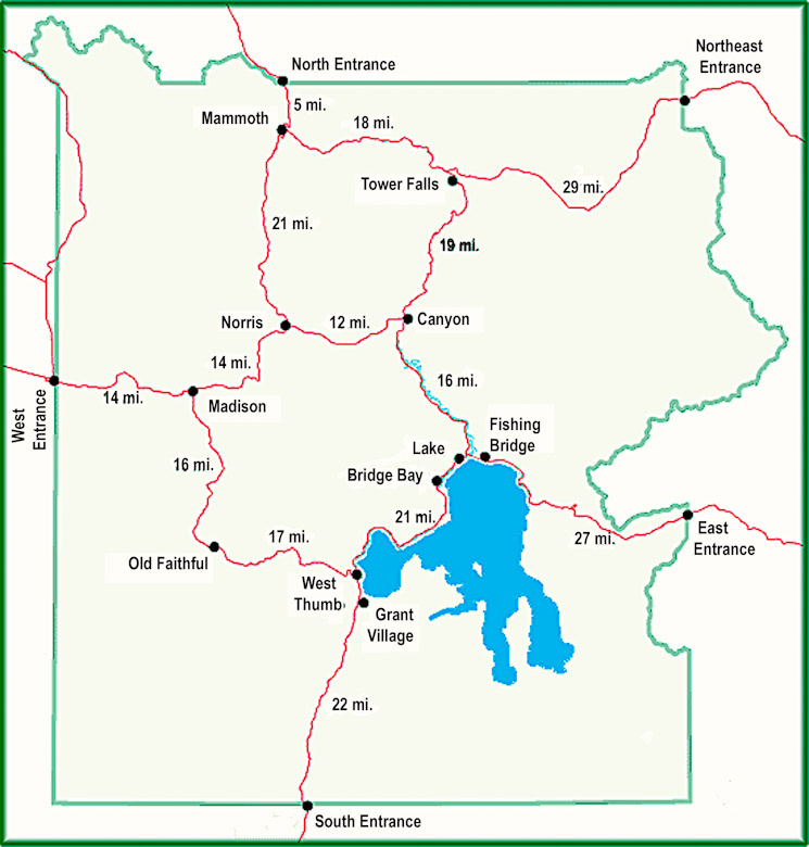
The above map gives you an idea of the layout of Yellowstone's roads. They are laid out in a figure eight with five connecting
roads radiating out of the park through the various entrances. If you add up the mileage of these roads you'll see that there can be quite a bit of
driving involved to get to the various areas of the park so you'll want to plan your base camp locations accordingly to minimize that drive time.
I prefer to split that time by staying in two different areas and that gives us more time to explore nearby regions rather than drive a large portion
of the day just to get there. Although, some of the best surprises we've had were on those unexpected drives. As mentioned earlier, all of the roads
are navigable by large RVs with the exception of one. That would be the 19 mile run between Tower Falls and Canyon. This road climbs Mount Washburn
via Dunraven Pass. The road has recently been repaved on Mount Washburn and the new blacktop is nice. However, there are very tight turns as the road
clings to the side of the mountain. It's going to be near impossible to keep a long motorhome that doesn't bend in the middle in your own lane. Couple
that with the fact that most oncoming drivers with minivans can't seem to stay in their own lane, throw in a ton of blind curves around cliffs, and
you have a real recipe for an exciting time. That's the one road in the park I won't drive in my RV. A major campaign was implemented over the last
20 years to repair Yellowstone's roads. The many potholed, narrow roads have now been upgraded to smooth, wider asphalt roads with additional pull-off
areas and are much better suited for large RVs. The last segment, currently in process, is the Gibbon Falls area between Norris and Canyon, but it too
is passable in it's present state.
Camping In and Around Yellowstone
Yellowstone is all about nature. Therefore the campgrounds that you find inside the park won't be the best for large RVs.
The only RV park inside Yellowstone with full hook-ups is Fishing Bridge Campground. It was built a long time ago and has 30 amp electric service plus
water and sewer. Many have described it as a large parking lot because the RVs are packed in pretty tight. The sites are all back-ins and they aren't
that long. There are a few sites capable of handling a 40' motorhome but not that many. Your toad will be parked right next to the RV. The site
immediately behind you is staggered so that their RV backs to your toad and your toad backs to their RV. There are shrubs to separate your site from
the one next to you. These shrubs were placed next to these narrow sites before slide-outs were invented. You'll undoubtedly find that it's going to be
very difficulty to extend your slides on a 40' quad slide coach without scratching them up on the dry shrubbery. However, it's the only site in the
park with full hook-ups. The majority of the other campgrounds won't even have a dump station, although there are exceptions. For more details on
Yellowstone's campgrounds check out the website at
http://www.nps.gov/yell/planyourvisit/camping-in-yellowstone.htm for more details. Fishing Bridge also has a great location, close to Hayden Valley
and Yellowstone Lake so if you have a smaller RV you may find the area a strategic location to explore that area of the park from. The parking lot
atmosphere may be overlooked because you won't be sitting around your RV anyway. Instead you'll be touring the park and only using the RV as
sleeping quarters.
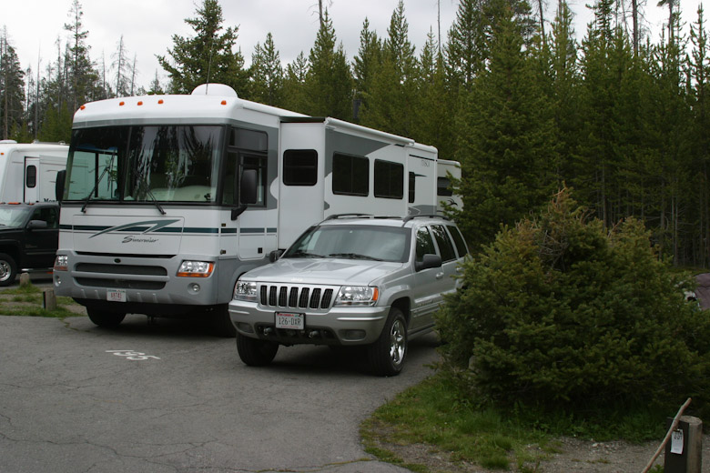
Typical Fishing Bridge campsite.
Mammoth has the only campground that is open year round. That's because it's on the only road that is open year round. It
has no water, electricity, or sewer so you will strictly be dry camping. Unlike Madison, Grant, and Bridge bay - there is no dump station either.
It is a roomy campground though so if you are coming in from the north entrance it is an option if you don't mind boondocking. It's a great location
for the fall elk rut.
If you would rather stay outside of the park and take the toad in, you have some better options. A number of private
campgrounds feature full hookups. Staying in Gardiner gives you access to the Mammoth area while staying in West Yellowstone gives you easy
access to Madison, Norris, and Old Faithful. It's also centrally located so shuttling across to Canyon and Fishing Bridge isn't all that bad,
although base camping in Fishing Bridge is always an ideal location. Note that there are no campgrounds by the ever popular Old Faithful area.
The closest is the no hookups campground at Madison or the full service campgrounds outside the park at West Yellowstone.
There are no full service campgrounds outside the northeast entrance or east entrance. The closest to the east entrance
is Cody, WY while the closest to the northeast entrance would be the campground in Sunlight Basin or else Red Lodge, MT.
For the official detailed map of Yellowstone National Park check out the following link -
docs/yellmap.pdf.
Grand Teton National Park
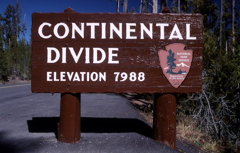
You'll cross the Continental Divide three times if trasveling between Yellowstone and the Tetons.
Many RVers visiting Yellowstone also visit Grand Teton National Park to the south. Leaving Yellowstone via the south
entrance takes you directly into that park. An easy, but scenic drive takes you over the gentle roller coaster hills of Yellowstone's southern
extremes and out onto the Snake River plateau where you'll see Jackson Lake at the foot of the Teton Range. Continuing on through the park on
US-89 will take you to Jackson, WY. Jackson is a good place to base camp and an interesting town with plenty of western atmosphere and any
kind of upscale shopping and dining you could possibly imagine. To see the Tetons you can stay at Jackson or you can also find a private park
just east of the Tetons at Moran Junction. To stay in the park you are limited to Flagg Ranch, Colter Bay, or Gros Ventre campgrounds and
most will not have hookups.
After you are done with the Tetons you can exit to the north, east, or south. The north will take you back to Yellowstone,
where you came from. Heading east from Moran Junction will take you over Togwottee Pass and then parallels the Wind River Range. Togwottee Pass is
not a problem for RVs so there's nothing to be concerned about. US-26 and US-287 run this very scenic route and eventually split off with US-287
heading south to Lander and eventually I-80 while US-26 heads up to Riverton, Thermopolis, and Buffalo and eventually I-90. If you exit the
Tetons to the south you can take a number of routes, US-189, US-191, or US-89 - depending on where you want to wind up. The only deal breaker
would be to take WY-22 west from Jackson which takes you over the steep and winding Teton Pass before dumping you out in Driggs, ID. That's one
pass you may want to reconsider with a large RV.
The Bighorn Mountains
The Bighorn Mountains are massive and can be formidable. Plus, if you are accessing Yellowstone from the east, they are
smack in the way. You can take I-90, which skirts around the Bighorns and goes through Montana, then drop down into Yellowstone from the north.
This is the easiest way and you stick to interstate highways until you get close to Yellowstone. However, it's also the longer way and not as
scenic as crossing Wyoming. There's pros and cons to both routes so I'll explain the Bighorns to you so that you can better understand them and
make your own decision.
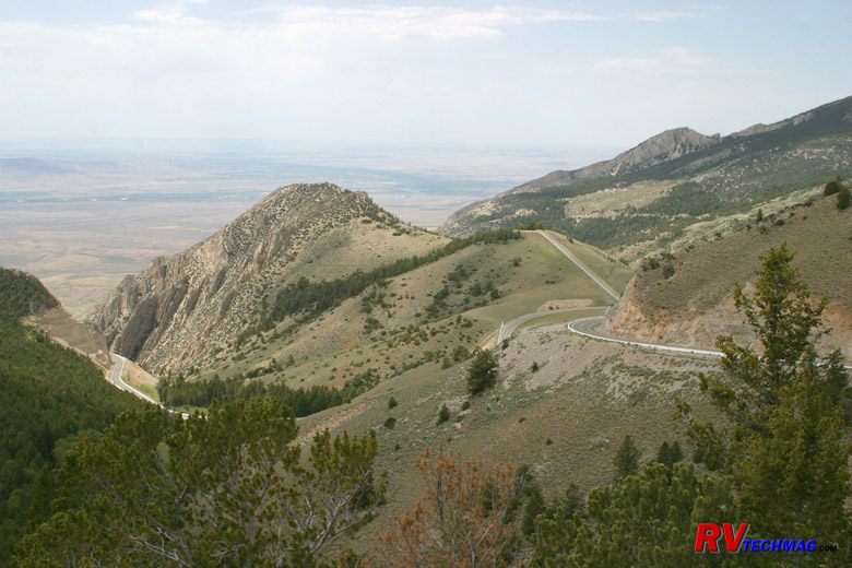
US 14A as it climbs the west flank of the Bighorn Mountains.
First of all, the Bighorns are a long range of mountains that runs north and south that sit smack in the middle of the way
of I-90 it heads west from the Black Hills and Gillette, WY. So I-90 chooses to go way to the north through Montana to skirt them. There are two
routes that do cross the Bighorns from the east, US-14 and US-16. US-16 leaves Buffalo, WY and goes over the southern end of the Bighorns while
US-14 leaves Ranchester, WY and goes over the northern end of the Bighorns. No roads do or could go over the massive center section of the Bighorns
and this area is designated as the Cloud Peak Wilderness area. US-14 further splits into two up top at Burgess Junction and descends the western
flank as either US-14 or US-14A, depending on which fork you take. To the west of the Bighorns is flat ranch lands. To the east of the Bighorns is
the Bozeman Trail valley that gradually climbs it's way to the north where I-90 enters Montana. The only issues with driving an RV in this area
is the actual crossing of the Bighorn Mountains themselves.
The southern crossing is the easiest. US-16 runs between Buffalo and Worland. If heading eastbound you leave Worland and
enter Ten Sleep Canyon shortly thereafter. This is a gradual climb that carries you alongside the Powder River as you ascend through the canyon.
It's a very scenic drive and eventually it reaches Powder River Pass. The climb up Powder River Pass is steep, topping out at 9,666 feet of altitude.
But, there are slow vehicle lanes and lots of turnouts and we've never had a problem here. You will be driving in some nice scenic high country for
a while before descending into Buffalo at 4,665 feet. The roads are wide, offer plenty of easy stretches to allow your RV to keep it's cool and
breath a bit, plus no terrorizing drop-offs. This road is a safe passage route for any RV traveling in either a westbound or eastbound direction.
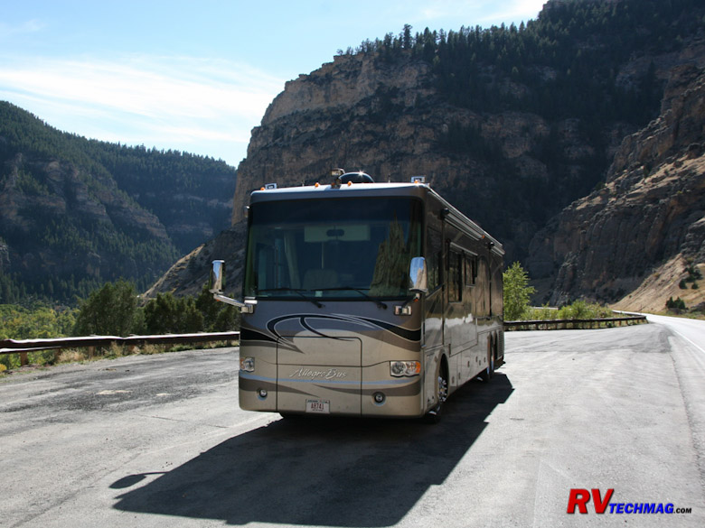
A scenic overlook in Ten Sleep Canyon on US-16 in the Bighorns.
The northern crossing is much different, however. Approaching the mountains from the east you'll enter a series of tight
switchbacks that sweep back and forth as they climb the grades on the east face. The difference between US-16 to the south and US-14 is that US-16
gradually builds it's altitude over time whereas US-14 runs up to the face of the mountains and then begins it's climb. Compare it to the difference
between a ramp and a ladder and you'll get the idea. Still, this is manageable for an RV. There are a number of pulloff areas and scenic turnouts
that you can use if needed. Once you have climbed the eastern flanks you'll be up top and driving across the Bighorns in the high country which
is a much easier drive.
The real problem with the northern crossing arrives once you get to Burgess Junction up top and have to deal with the west
face of the mountains. Once you get to Burgess Junction there is a sign directing all trucks and large vehicles to pull over and that they must
read the large sign posted there. following is an image of that sign:
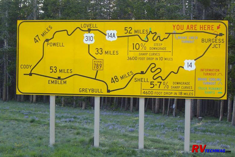
The warning sign at Burgess Junbction at the top of the Bighorns, where US-14 and USD-14A merge.
Descending to the west the road splits. US-14 heads down to Greybull while US-14A takes a more northerly route through Lovell.
Eventually both meet up at Cody, WY. The problem here is that the grades are steep, long, and there is no place to get a break on them. No flat areas
to let your coach breathe nor any pulloff areas to let them rest. This means that your brakes will become overheated, fade, and you won't be able to
retard your descent speed. You'll probably wind up doing a swan dive over a switchback's cliff. For this reason I recommend that you NEVER take an
RV in a westbound direction via US-14 or US-14A. If you are heading west, either take I-90 and skirt them to the north or take the more scenic US-16
to the south.
If you are heading eastbound, the situation changes. We've taken heavy RVs over all three of these routes in an eastbound
direction. While the northern routes aren't a whole lot of fun, they are doable.
Normally we'll prefer to take US-16 because it's scenic and it winds up in Buffalo rather than Sheridan. If you climb US-14
from Greybull to Burgess Junction it's a stiff climb. First you drive through a real desert-like waste land, which is scenic in it's own right, then
you approach Shell, WY. From Shell, the steep climb begins and you'll be pedal to the metal for a long time as you gradually climb those 15 miles
at 25-35 MPH. If your cooling system is in good order this is doable. We've done it with 33' gasoline , 40' diesel, and 42' diesel motorhomes
without any problems. We do unhook the toad for this climb and drive in tandem to help relieve some of the weight. Once up top you can rehook and
rest the RV while you look back at the flat valley below, which unfortunately is usually a bit hazy as far as good photographs go. Once up top
it's an easy drive to the east face, where you then have to descend the switchbacks as you make your way down to Ranchester. Heading down the east
face isn't as bad as the west face. The east face has plenty of scenic turnouts where you can rest your RV and cool off your brakes. Therefore,
crossing the Bighorns via US-14 is okay if you head in an easterly direction but not in a westerly direction.
US-14A is the same as US-14 except it's even worse. It's even steeper than US-14 and they've added two runaway truck ramps
to help prevent total wipeouts on that road. We've climbed that road as well but it's the most extreme climb we've ever made and there is literally
no place to catch a break until you get to the top. The only reason I see for taking this route is if you wanted to see the Pryor Mountain wild
mustang herds in the Bighorn Canyon, just north of Lovell. If that's not on your itinerary scratch this route of your list. If it is, be sure to
make this another "eastbound only" route.
My Personal Recommendations
Okay, now that you've been given the overlay and descriptions you might ask which way I would go. The truth is, we've taken
many different routes because we've had different scenic goals throughout the many trips we've taken. Each version depends on what your goals will
be and how much time you have to manage them.
If you only have 4-6 days in Yellowstone and are coming from the east, and want the most scenic bang for the buck I'd do my
favorite route - Plan A. If you have 6-8 days and want to include the Tetons I'd go with Plan B. My personal opinion is that the Tetons are "okay"
in summer but with 5 days or less I'd skip them and concentrate on Yellowstone. However, in fall things really change in the Tetons and if you have
the time I'd definitely go see them. If your fall trip is only 6 days I'd recommend going with Plan A and making the Tetons a day trip with the
toad, leaving from and returning to West Yellowstone. If you have more days you can go with Plan B and stay in Jackson for a few days. In fall the
Tetons come alive with moose and elk and the Aspens change to bright golden hues the end of September. Grand Teton park is vibrant in the fall but
somewhat bland and dead in the summer.
|
If you only have 4-6 days in Yellowstone and are coming from the east, and want the most scenic bang for the buck I'd
do my favorite route - Plan A. If you have 6-8 days and want to include the Tetons I'd go with Plan B. My personal opinion is that the Tetons
are "okay" in summer but with 5 days or less I'd skip them and concentrate on Yellowstone. However, in fall things really change in the Tetons
and if you have the time I'd definitely go see them. If your fall trip is only 6 days I'd recommend going with Plan A and making the Tetons a
day trip with the toad, leaving from and returning to West Yellowstone. If you have more days you can go with Plan B and stay in Jackson for
a few days. In fall the Tetons come alive with moose and elk and the Aspens change to bright golden hues the end of September. Grand Teton
park is vibrant in the fall but somewhat bland and dead in the summer.
|
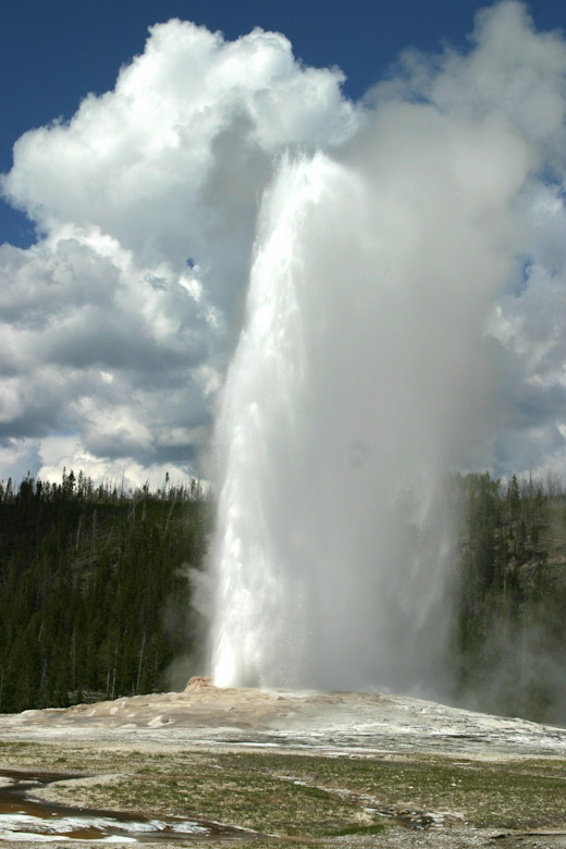
Old Faithful is the number one attraction in Yellowstone.
|
If you are not comfortable with mountain driving and would prefer to skip the Beartooths in favor of a more sedate drive,
I'd go with Plan C. It's an easy drive with decent scenery and you won't have any stress. Many RVers are comfortable with the Beartooths but there
are enough that just want "easy" so Plan C is a good choice. Plan D is if you want to visit the wild mustang herds in the Pryor Mountains. Then
you'll need access to Bighorn Canyon, just north of Lovell, WY which means you'll exit Yellowstone via the east entrance and take US-14A from Cody.
Plan A
Approaching from the east you'll be coming into Montana on I-90. (A quick note here - If you are planning on seeing the
Black Hills on this trip do it prior to seeing Yellowstone. The Black Hills are nice and
Custer State Park is an excellent state park, worthy of national
park caliber. However, after seeing the spectacle of Yellowstone it just won't measure up. Seeing the Black Hills after you've finished Yellowstone is
sort of like eating your potatoes after you've finished your dessert. Shortly after passing through Billings, MT you'll pick up US-212 at Laurel. Take
it south to Red Lodge, MT. Stay there at one of the RV parks in the area. You have a few options here but it's important to stay at Red Lodge so that
you are within striking range of the Beartooths and Yellowstone's northeast entrance. If you get here mid-day you won't have enough time. You'd be
driving like crazy just to cross the Beartooths and make it to your Yellowstone destination by supper or early evening, depending on where your
destination is. So, plan on base camping in Red Lodge.
|
The next day you can leave at 8 AM to make the trip over the Beartooths, this will get you to Top of the World Store
just before lunch. Then you can unhook the toad and do some exploration of the side roads. This also gives you adequate time to pull over and
admire the scenery on the way up the Beartooths. After lunch you can head down through Cooke city and into Yellowstone via the northeast entrance.
You'll pass through Lamar Valley and arrive at Tower Junction mid afternoon. You will then take road that crosses the northern end of the park
to get to Mammoth. Your only other choice is south to Canyon but that would take you up over Mount Washburn via Dunraven Pass and you don't want
to do that in a large RV. Save that for the toad later on.
|
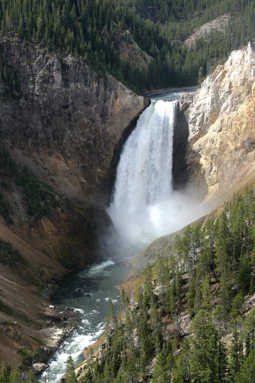
The Yellowstone River plunges 308' into the Grand Canyon of the Yellowstone at Lower Falls.
|
Once at Mammoth you have some more options. You can continue south through Norris and Madison to get to West Yellowstone where
you can stay at one of the full service RV parks, generally Grizzly RV Resort. You can do this
if your time is limited or you just don't want to split it up by staying at multiple locations. Otherwise, you can stay in Gardiner at one of the two
RV Parks there for a couple of days, then move south to West Yellowstone. We prefer to do this because it gives us the ability to explore Mammoth,
Norris, Tower Falls, and the Blacktail Plateau area with minimal driving time shuttling back and forth from West Yellowstone. Another option would be
to stay at the no services campground (but roomy) at Mammoth.
An alternative to the one night stay at Red Lodge would be to do 2-3 nights there. If you have the time, this is ideal. You can
take the toad up into the Beartooths and explore the area as well as get a greater feel for Red Lodge itself. It would also give you a great chance to
see the switchbacks that climb the Beartooths and once you've done that you can decide whether or not to climb them in the RV or take the Belfry bypass
and come in on the Chief Joseph Highway mentioned earlier, thereby bypassing the steep climb. The Belfry bypass is also a great backup route on a fall
trip should a sudden snowstorm blanket the north face. Another option is to leave Red Lodge to the north via Absarokee and head over to Bozeman and then
down to West Yellowstone. This is a bit more mileage but it's easy driving and the higher highway speeds will get you ther ein about the same time. You
can also do a similar route to get to Gardiner or Mammoth if that is your destination. Again, same travel time but more miles.
Once you are done with West Yellowstone and have seen the park, head east to Canyon, then south to Fishing Bridge, and then out
the east entrance. Leaving west Yellowstone at 8 AM, you'll pass through Pahaska, Shoshone Canyon, Wapiti Valley and arrive at Cody, WY late morning.
If you want to stay at Cody at one of the full service RV parks there you don't have to leave that early but if you want to continue on, you'll need to
leave at 8 AM so that you can reach Buffalo by 5 PM. From Cody I'd head east on US-14 to Greybull. If you are interested there is a large airport there
with fire fighting bombers that you can tour. After Greybull, head south to Worland where you can pick up US-16 and head east to Buffalo. US-16 is the
easiest drive across the Bighorns and goes through some spectacular scenery, including Ten Sleep Canyon. We stay at the Indian Campground in Buffalo
and try to east at the Occidental Hotel, which is an old restored hotel that Butch Cassidy
frequented and now serves excellent dining fare, including great western steaks and prime rib.
Note that you can choose to take US-14 or US-14A east over the Bighorns to get to Ranchester and eventually Sheridan but be sure
to read the section on the Bighorns before doing so.
|

Bull elk are active during the fall rut.
|
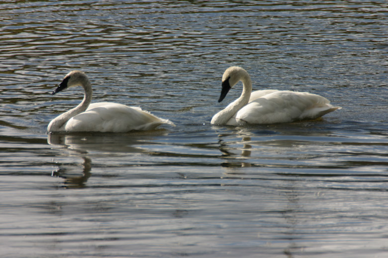
Trumpeter swans can be found in various places in the park.
|
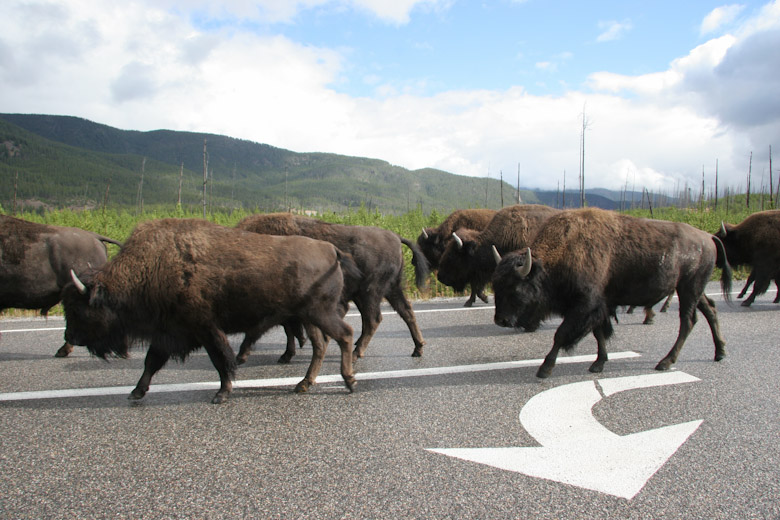
Bison use the roads whenever they want and you need to allow adequate time to allow for bison jams when driving in the park.
|
Plan B
This similar to Plan A in that the entrance to Yellowstone is identical. However, it includes staying at Grand Teton National Park
so the exit path is different.
Taking the above information into consideration, arrive at West Yellowstone and do your sightseeing accordingly. Once you are done
with Yellowstone, leave West Yellowstone and pass by Old Faithful and Lewis Lake on your way out of the park through the south entrance. You'll then drive
along the Nelson Rockefeller Parkway alongside Jackson Lake, arriving at Oxbow Bend just in time for lunch if you leave West Yellowstone around 8 AM.
There's a nice pulloff area there and you may see moose in this area as well as a nice backdrop of the Tetons reflecting in the Snake River. Continuing
on you can either stay at the nearby Grand Teton RV Resort, immediately outside the park at
Moran Junction or head south to Jackson, WY. We prefer to stay at
The Virginian Campground in Jackson due to its proximity of services in downtown Jackson as well as the southern regions of the park itself. Be sure
to eat at the Gun Barrel Restaurant for excellent steak and wild game. It's within walking distance
from The Virginian.
After we have finished with the Tetons we drive up to Moran Junction and head east. Crossing the scenic but easy Togwottee Pass you
are quite apt to see moose in the roadside habitat. This will also take you through Dubois, WY where you may want to stop and see the
Bighorn Sheep Center there. Dubois is home to the National Bighorn Sheep Preserve on Whiskey
Mountain so you might want to see that as well. The Dubois KOA is a great choice should you decide to do that. If you want to skip Dubois, just keep on
driving through. We follow the road to Riverton, then up to Thermopolis and generally park at a pulloff area overlooking
Thermopolis Hot Springs State Park and eat lunch there. After
Thermopolis we head to Worland and then through Ten Sleep Canyon to Buffalo.
A quick note on Buffalo - There is a lot to see and do here and it must be a well kept secret because no one seems to know that.
The Bighorns are spectacular and full of wildlife as well as wildflowers in late July. The area north of Buffalo is full of cavalry battles along the
Bozeman Trail and eventually leads to the Little Bighorn Battlefield, just 120 miles to the north. Butch Cassidy's Hole in the Wall is to the south near
Kaycee. You could spend plenty of time here as well.
|
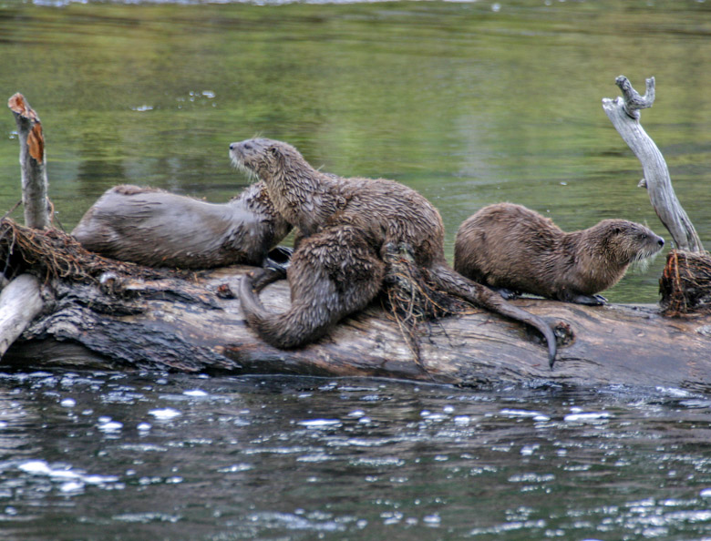
River Otters resting on a log in the Madison River.
|
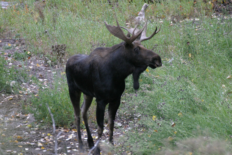
Mooase are generally found in wet habitat lush with sedges or willows.
|
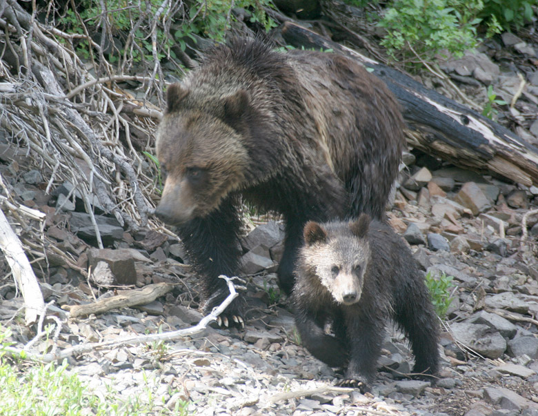
Grizzly bear are found throughout the park but not always seen by visitors. This sow and cub were seen near the east entrance.
|
Plan C
This is the one that skips the northeast entrance and the Beartooths in favor of a leisurely drive to West Yellowstone.
Take I-90 west to Bozeman, MT. From Bozeman take US-191 south through Big Sky and the scenic Gallatin Canyon. This will take you
into West Yellowstone via a fairly flat (for Montana anyway) and non twisty 3 hour drive. We stay at Sunrise Campground whenever there. Leaving
Yellowstone you can use either the tail end of Plan A or Plan B.
Plan D
This route can be used regardless of which entry route you choose to take into Yellowstone. The exit route takes you to Cody, WY
where you'll split off on US-14A to see the Pryor Mountain wild mustang herds in the Bighorn Canyon north of Lovell. Finally you'll cross the Bighorns
via the super steep US-14A climb on the west flank of the mountains.
You'll exit Yellowstone via US-14, which takes you to Cody, WY. It's best not to leave Yellowstone in the morning or else you'll
have to really rush to see the mustangs in the Bighorn Canyon. Then you'll wind up rolling into Sheridan, WY right at supper time and you'll be forced
to stay at the so-so Sheridan KOA rather than continue on to the much nicer campgrounds in Buffalo. I'd recommend staying at Cody if you want to see the
Mustangs. It's an easy half day drive to Cody from West Yellowstone so that'll give you the afternoon to see the sites of Cody and put you within
striking range of the mustangs for the next day's departure. Leaving Cody will get you to Lovell late in the morning. You can park the RV at the Bighorn
Canyon National Recreation Area visitor center and take the toad in to see the mustangs.
After a few hours of sightseeing plus some time for lunch you can then begin your ascent of the Bighorns via US-14A. You can leave
your toad unhooked when leaving Lovell if you want so that you don't have to stop and do it later. It'll make a big difference when you begin your climb.
When you finally get to the top you can pull over at a scenic turnout and let the RV rest a bit while you reconnect the toad to the RV and take some
scenic pictures. Then you cross over the top of the mountains, stopping at Burgess Junction if you like, and finally pick your way down the much easier
switchbacks on the east flank of the mountains. Then you'll head through ranch country until you reconnect with I-90 and head south to Buffalo.
Additional Photos and Side Trip Information
Finally, I'll include some photos and notes on two side trips that you may want to take in your towed vehicle. These are the
Beartooth Highway and the wild mustangs of Bighorn Canyon.
The Beartooth Highway
The Beartooth Highway is one of those drives that should make it to everyone's bucket list. One of those things you have to do at
least once before you die.
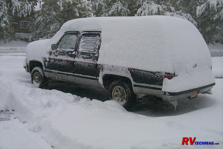
Prior to our RV trips we traveled with Suburbans. One September, while staying in the Best Western in Red Lodge we awoke the next
morning to find a foot of snow on our Suburban. They had gotten close to two feet of the stuff up in the Beartooths. We wound up heading back up to I-90
and then over to Bozeman and then down through West Yellowstone to get into Yellowstone. While this was an extreme anomaly, weather can be very
unpredictable in the mountains and September travelers need to be prepared for most anything.
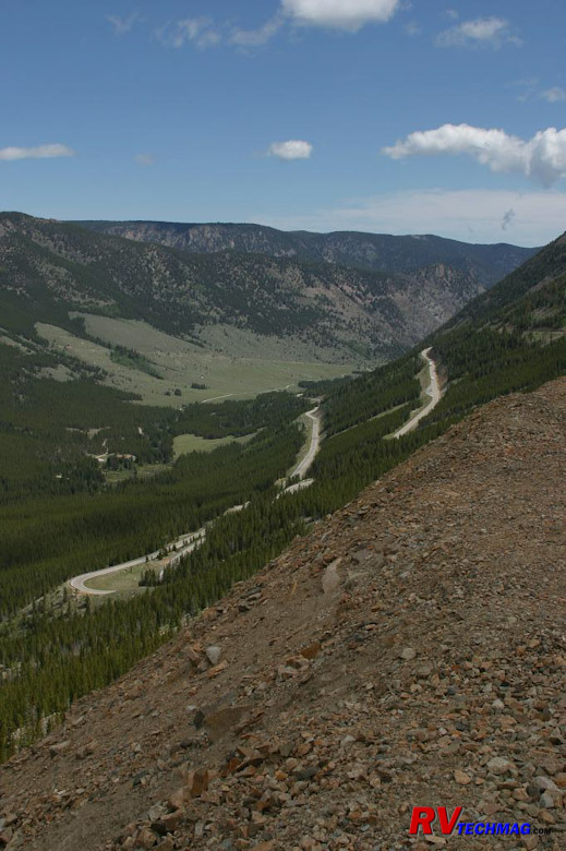
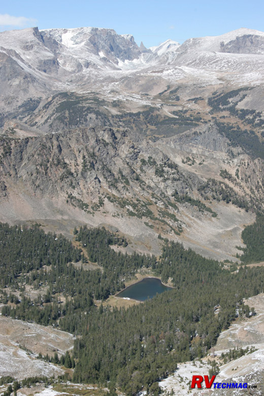
The Beartooth Highway begins by climbing a series of switchbacks on the Red Lodge side. The image on the left shows a portion
of these as they begin their climb through the forested slope in the lower portions of the highway. Eventually you'll reach alpine tundra and you'll
look down into glacial carved valley with pothole lakes, as shown on the right.
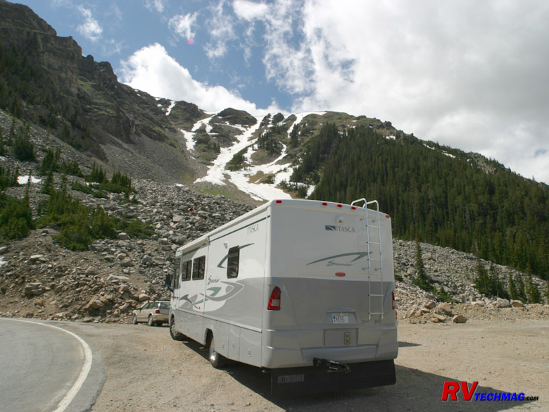
As you climb the Beartooth's switchbacks you'll encounter a number of areas where it'll be possible to pull over to enjoy the view
and give your RV a rest break.
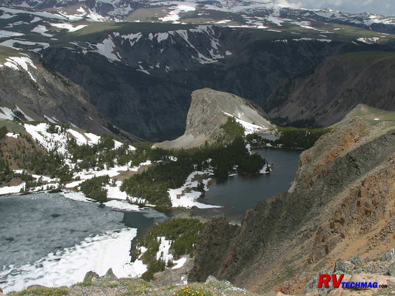
Once you climb above tree line you'll be able to look down into frozen lakes.

The Beartooth Highway doesn't open until right around Memorial Day. They get some serious snow up there over winter and that
takes time to remove. This mid June image shows you one of the drifts alongside the road.

Reaching the West Summit you'll be at close to 11,000' of altitude. From this point you'll be able to look down on neighboring
snow capped mountains as you begin your descent into the saddle that crosses the Beartooths.
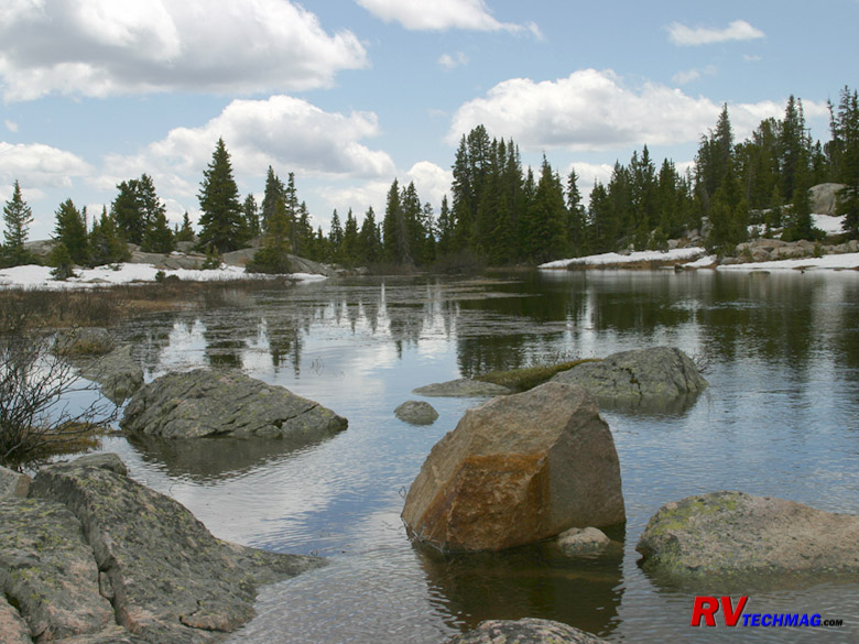
There are many small lakes that you'll encounter driving across the top of the Beartooths. Island Lake and Little Bear Lake
are popular vistas.
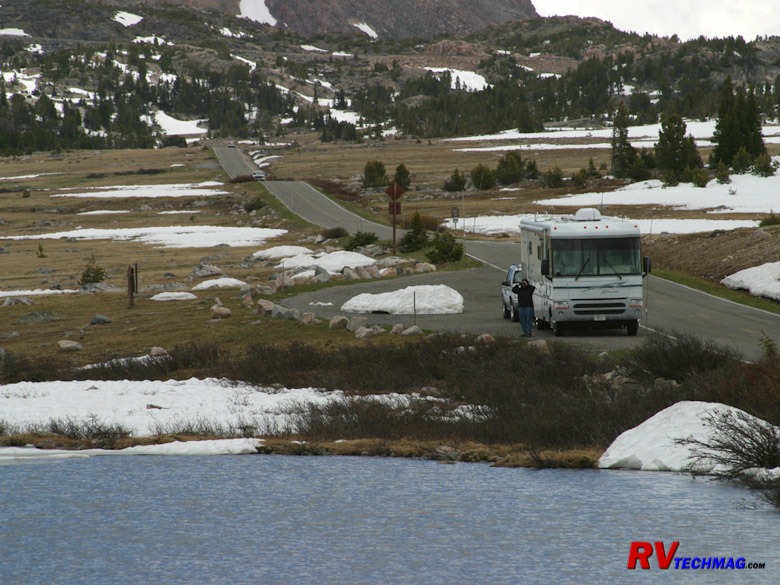
Little Bear Lake is easily accessed from a turnout on the Beartooth Highway. Shortly after passing Little Bear Lake you'll
arrive at Top of the World Store.

Top of the world Store does have campsites available. They are somewhat rough and there is no electricity available because the
owner runs his store via a small generator and has no power to spare. However, there are water and sewer hookups and the water is the best tasting in
the world. It can be a great location to base camp from if you want to play around in the Beartooths but in June many of the trails and dirt roads will
be snowed in and in September the weather moves in fast at 10,000' so you have only July and August to truly spend any time in an RV and still be safe
weather-wise at this altitude.
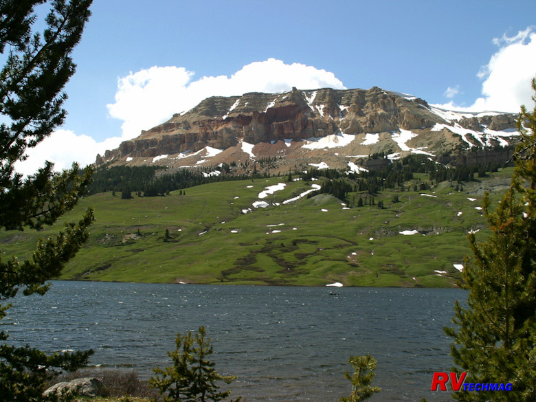
Just down from Top of the World Store is Beartooth Lake, which lies at the base of Beartooth Butte. A hiking trail surrounds
the lake.
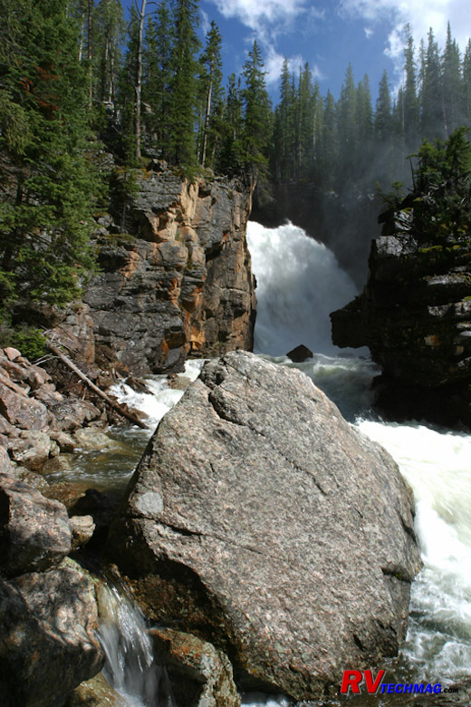
Continuing past Beartooth Butte is Sill Falls, where the creek crashes down the side of a mountain into a deep valley below.
The Mustangs of Bighorn Canyon
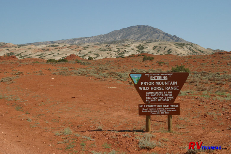
Just north of Lovell is the Bighorn Canyon National Recreation area. If you stop at the visitor center you can drop the RV
and take the toad up the road into the Pryor Mountain Wild Horse Range to view the mustangs.
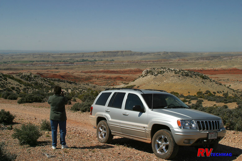
The Pryor Mountain Range is a wide, expansive area. Rather than the typical mountain jutting up from your location, you are
actually up on top of the mountains and many of the views are canyon-like.
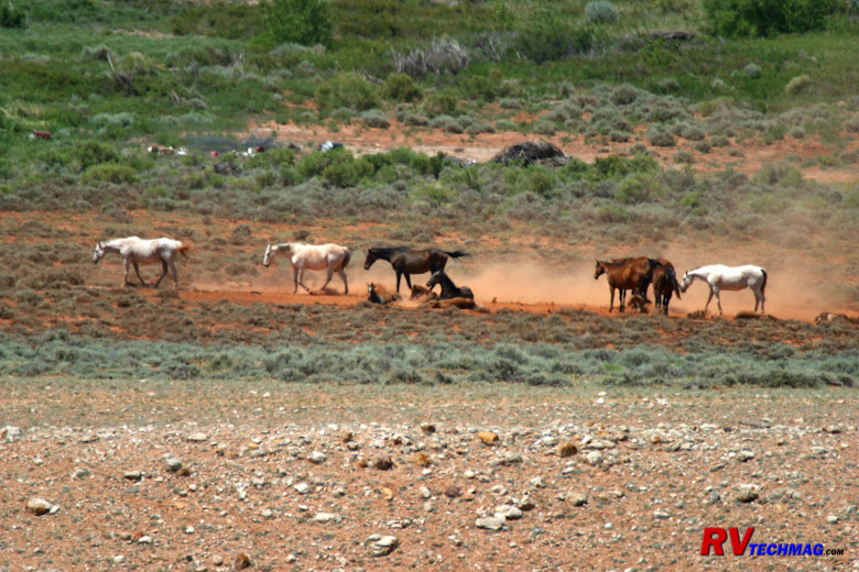
Within the varied terrain of this area you will find herds of wild mustangs. A short hike from the road generally put you
within photo range.
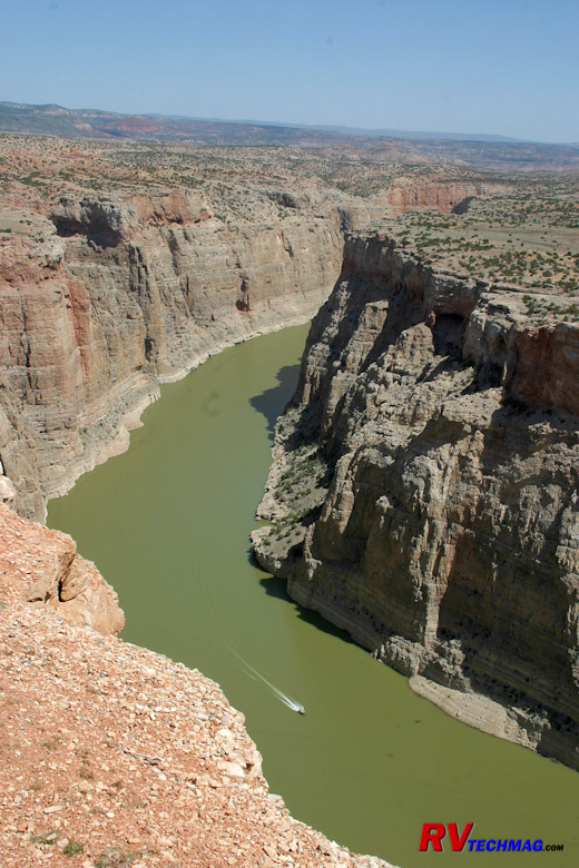
Even without the wild mustangs, the Bighorn Canyon in itself is very scenic. The canyon was created as the Bighorn River
flowed and carved it's way through the softer limestone, creating an ever deepening canyon.
Summary
Okay, I've probably overloaded you with information. Hopefully, it'll help you to plan your trips to this area. There's far
more to see and do here that could be undertaken in even an entire summer so lay out a basic overview trip and plan on returning later to further
dive into specific areas that interest you. Do try to allocate plenty of time though. The biggest mistake is to only allow a few days in Yellowstone.
You need a bare minimum of 4 days just to cover the highlights while 6-7 does a much better job. Each season has it's pros and coins. Much of
everything is still snowed in in spring so mid-June is the earliest that you can travel here without encountering too many closures. The streams
and waterfalls are impressive as they are filled with snowmelt runoff. July and August are always safe bets weather-wise but that's when the crowds
are at the highest too. Also, the hotter temps and sun tend to keep the wildlife hidden during the day as they seek shade and rest. Fall signals
the beginning of the elk rut, which is always spectacular. Plus the kids are back in school so the crowds are down, although many support facilities
close down mid September so there's tradeoffs either way. The main thing is to just get there, take lots of pictures, and enjoy. Have a safe trip.
Source
Return to Home Page
If you enjoyed this article be sure to recommend RVtechMag.com to your friends, like us on Facebook or Twitter
or subscribe to our RSS feed.


|


